East Asia and Southeast Asia Map Guide for 2026
8/4/2026
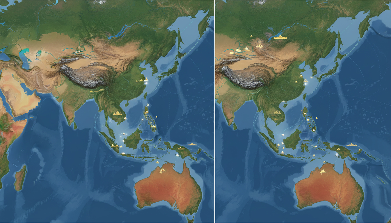
In short, what you'll discover in this article: a clear and detailed overview of the east asia and southeast asia map, highlighting geographic, political, and cultural distinctions. Explore interactive maps, country lists, thematic layers, and travel-focused resources to better understand these vibrant regions.
1. Introduction — Why an East Asia and Southeast Asia Map Is Useful
Understanding the east asia and southeast asia map is essential for grasping the geographic layout, cultural diversity, and political boundaries of these two dynamic regions. Whether you're planning a trip, studying Asian cultures, or simply curious about the countries in East Asia and Southeast Asia, a clear map helps visualize their locations and relationships.
This article addresses the need for a detailed yet easy-to-read map that balances physical features with political borders and major urban centers.
East Asia includes countries like China, Japan, South Korea, and Taiwan, while Southeast Asia covers nations such as Indonesia, Thailand, Vietnam, and the Philippines. Knowing their borders and topography enhances your understanding of regional interactions and travel logistics.
2. General Interactive Map — Overview
To get an immediate sense of the regions, an interactive east asia and southeast asia map offers a comprehensive view with zoomable features. This map clearly outlines all countries in both regions with distinct borders and highlights major cities.
You can explore physical features like mountain ranges and rivers or switch to political views showing country boundaries.
2.1 Legend and Available Layers (Physical, Political, Cities, Infrastructure)
The interactive map includes several layers for tailored exploration:
- Physical Layer: Shows mountains such as the Himalayas in East Asia and the Annamite Range in Southeast Asia.
- Political Layer: Highlights country borders clearly with color-coded nations.
- Cities Layer: Marks major urban centers like Beijing, Tokyo, Bangkok, and Singapore.
- Infrastructure Layer: Displays key airports, ports, and major highways connecting economic hubs.
This flexibility allows users to focus on specific interests—whether geography enthusiasts or travelers planning routes.
3. Boundaries and Definitions — What Does East Asia vs Southeast Asia Cover?
The distinction between East Asia and Southeast Asia is both geographic and cultural:
- East Asia generally includes China, Japan, Mongolia, North Korea, South Korea, Taiwan, and sometimes parts of Russia’s Far East.
- Southeast Asia comprises countries south of China’s border down to Indonesia and the Philippines. It is bordered by East Asia to the north, South Asia to the west, Oceania to the east, and the Pacific Ocean to the southeast.
3.1 List of Countries and Territories by Region
Here’s a breakdown of countries classified by region with links to detailed country pages:
-
East Asia:
- China
- Japan
- South Korea
- North Korea
- Taiwan
- Mongolia
-
Southeast Asia:
- Brunei
- Cambodia
- Indonesia
- Laos
- Malaysia
- Myanmar
- Philippines
- Singapore
- Thailand
- Vietnam
These classifications help clarify cultural zones as well as political boundaries.
4. Essential Thematic Maps
To deepen your understanding of these regions beyond borders:
4.1 Relief, Mountains, and Major Waterways
The physical map of Southeast Asia reveals mountain ranges like the Annamites running through Vietnam and Laos. East Asia’s topography features the towering Himalayas on its western edge plus significant rivers such as the Yangtze in China.
4.2 Population Density and Urban Centers
Maps showing population density highlight urban hotspots such as Tokyo (East Asia) and Jakarta (Southeast Asia). These centers are economic powerhouses with dense populations influencing regional dynamics.
4.3 Maritime Routes, Ports, and Logistics Hubs
The economic zones in East and Southeast Asia depend heavily on maritime trade. Key ports like Singapore in Southeast Asia serve as global shipping hubs.
The map also shows strategic sea routes vital for commerce.
5. Islands, Maritime Borders, and Disputed Zones
5.1 Focus on the South China Sea and Strategic Straits
The South China Sea is a critical area featuring disputed maritime claims among several countries in Southeast Asia. Important straits include:
- The Malacca Strait: A vital shipping lane between Malaysia and Indonesia.
- Taiwan Strait: Separates Taiwan from mainland China.
These waterways are crucial for regional security and trade.
6. Maps for Travelers and Practitioners (Routes, Travel Times, Airports)
Travelers benefit from maps highlighting:
- Flight routes connecting major airports like Singapore Changi Airport.
- Estimated travel times between key cities.
- Recommended itineraries covering cultural landmarks across both regions.
For example, Singapore’s eSIM solutions for tourists make staying connected easier when exploring Southeast Asian cities (Singapore eSIM Tourist).
7. Downloadable Resources and Technical Files (PDFs, SVGs, GeoJSON) — How to Use Them
For educators or planners requiring offline access or GIS integration:
- PDF maps provide printable versions for quick reference.
- SVG files allow scalable graphics for presentations.
- GeoJSON files support geographic information systems for detailed spatial analysis.
These resources facilitate teaching about the geography of Southeast Asia or planning logistics across borders efficiently.
8. Educational Uses and Practical Applications (Teaching, Research, Logistics Planning)
Maps of East Asia and Southeast Asia serve multiple purposes:
- Teaching cultural regions or political geography.
- Conducting research on demographic trends or economic zones.
- Planning supply chains considering topography and infrastructure.
For tech professionals interested in regional connectivity options in Hong Kong or mobile app development related to these markets see Mobile App Development Hong Kong or China Mobile Hong Kong.
9. Conclusion
A well-designed east asia and southeast asia map is invaluable for travelers, students, researchers, or anyone curious about these vibrant regions. It clarifies complex borders while highlighting physical features and urban centers crucial for understanding regional dynamics.
For travelers heading to Singapore or nearby areas, consider exploring eSIM options through trusted providers listed on MyBestSim to stay connected effortlessly during your journey.
Explore our interactive maps embedded here or download resources to deepen your knowledge today!
Appendix: Sources and Cartographic Credits
Maps referenced here rely on authoritative data from sources such as the CIA World Factbook (East and Southeast Asia – World Regional Geography) as well as detailed cartographic collections from the U.S. Library of Congress (Map Southeast Asia). These ensure accuracy in depicting political boundaries alongside physical geography for your learning convenience.
FAQ
What countries are included in East Asia and Southeast Asia?
East Asia includes China, Japan, South Korea, North Korea, Taiwan, and Mongolia. Southeast Asia covers countries like Indonesia, Thailand, Vietnam, the Philippines, Malaysia, and others south of China’s border.
How does the interactive map help travelers in these regions?
The interactive map highlights major cities, airports, and travel routes, helping travelers plan trips efficiently. It also shows estimated travel times and key infrastructure like ports and highways.
What physical features are shown on the East Asia and Southeast Asia map?
The map displays mountain ranges such as the Himalayas and Annamites, major rivers like the Yangtze, and important waterways including strategic straits like the Malacca and Taiwan Straits.
Why are maritime borders important in Southeast Asia?
Maritime borders in Southeast Asia involve disputed zones like the South China Sea, which are crucial for regional security and trade. Key shipping lanes such as the Malacca Strait support global commerce.
What downloadable map resources are available for offline use?
Users can download PDF maps for printing, SVG files for scalable graphics, and GeoJSON files for GIS applications. These resources support education, research, and logistics planning.

Liam Chen
Liam is a travel and technology writer based in Southeast Asia who has tested eSIMs across the region. At Singapore eSIM he compares travel data plans on Singtel, StarHub and M1 and helps visitors stay online affordably from Changi to Sentosa.